When Noah Charney and his wife were house-shopping near Philadelphia, one real estate agent after another claimed to have the ideal home for them, and couldn’t wait to offer a virtual tour of its features: the renovated kitchen, the ample closet space.
But the listings never included the image that Dr. Charney, a conservation biologist, most needed to see: the satellite view from Google Earth.
“You want to see what?” was the typical response when he suggested opening an extra browser tab so he could explore the properties in an entirely different way before deciding which ones to see in person.
The decision, he knew, wouldn’t hinge on square footage or the number of bedrooms and bathrooms, but on location, location, location. To Dr. Charney, that meant a lot more than a street address.
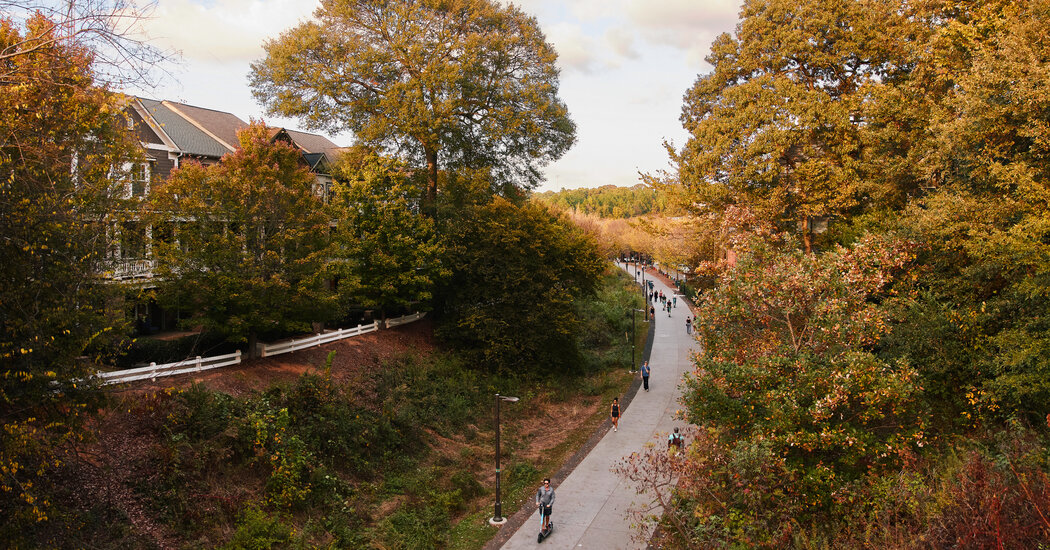
He had done preliminary online scouting of the larger area using satellite imagery and had identified three places with forest remnants that had escaped development. They looked like his sort of neighborhoods — the kind likely to appeal to the greatest possible diversity of birds and other wildlife.
Were any of the houses being suggested contiguous to those areas?
“I wanted to see, in part, what animals could survive there, and would be in our yard,” he said. “Because what’s next to it informs what is going to end up there.”
Today, he and his family live in New England, splitting their time between Orono, Maine, where he is an assistant professor of wildlife, fisheries and conservation biology at the University of Maine, and Western Massachusetts, where they used to live full-time.
Dr. Charney is an advanced practitioner of reading the land and the author of the 2023 book “These Trees Tell a Story: The Art of Reading Landscapes.” He divines information about a landscape’s past and present, and hints of its future, from clues and patterns most of us wouldn’t notice or think to look for, even when the place in question is as familiar as our backyard or the park where we walk the dog every day.
He is a sleuth by nature, endowed with the gift of deep curiosity, arguing in his writing and teaching for the need to heighten our intimacy with the places in our lives — and showing us exactly how to do that.
Finding Our Place on the Map
Do you really know where you live?
To get a better sense of a place, even one you think you know, Dr. Charney said, don’t start too small. Whenever he explores — whether it’s on a hike, teaching a class in the field or in that long-ago home search — he begins by using maps to expand his perspective beyond human constructs like property lines and town boundaries.
“Get a satellite map and look down, and look at your place, and look around,” he said. “What is it connected to? What’s the nearest river or wetland or hill or big, expansive forest? And get to thinking about if you’re an animal, if you want to wander.” Where would you go?
The Northern leopard frog, for instance, breeds and overwinters in water, but a meadow of longish grass is its preferred summertime habitat. If that’s not in your immediate backyard, are there places nearby that could accommodate the amphibian, whose numbers have been decreasing?
Satellite imagery from Google Earth can reveal the relationship of a particular place to forest remnants like those Dr. Charney saw around Philadelphia, and topographic maps can tip us off to a range of features, from the elevation of the land to any bodies of water in the vicinity.
Dr. Charney uses the United States Geological Survey national map viewer. Many states and counties have their own viewer portals revealing local conservation corridors and other environmental layers. (A few examples include New York’s Environmental Resource Mapper tool, Maine’s Beginning with Habitat viewer and the MassMapper from Massachusetts.)
Getting a more intimate sense of place also requires on-site checks, some more obvious than others. If your land slopes, for example, what is the aspect: Which direction is downhill?
North-facing slopes, which face away from the sun in the Northern Hemisphere, offer moister, cooler environments; sunnier, south-facing slopes generally have drier soils. Those are “two really different habitats on those two sides,” Dr. Charney said, and especially in a hilly neighborhood, the extremes can exist side by side, “just down the road and around the bend.”
Another characteristic of slopes: They can have wide variations in soil depth. But rather than thinking of a particular depth or kind of soil as good or bad — a judgment often based on what we hope to grow — Dr. Charney encourages us to cultivate an awareness of how it got there.
Soil, he said, basically “comes from the rocks below the surface weathering, and the plants above the surface decomposing generally.”
Higher areas on slopes have less soil buildup, and tend to be erosional zones. “If you dig down and suddenly you hit rock, and there’s no soil — that’s an erosional zone,” he said.
At the bottom of the slope, where all that eroded material from above came to rest, “if you can just keep on digging and you can’t find the rocks,” he said, it’s a depositional zone.
Go ahead and put your shovel in the ground. Pull it away from the side of the hole and look: Do you see defined layers, or bands of various color?
“Has it been tilled, disturbed by people recently, or does it still have those natural horizons in it?” Dr. Charney asked.
Wind moves soil and, in floodplains, water transports it. So do glaciers, like those that once occupied the land where Dr. Charney’s Massachusetts home now stands. Some 10,000 years ago, his property was near a glacial lake, before the last ice age receded. So it’s not surprising that there are no rocks in the yard.
“The house itself is down below lake level,” he said, “where there’s lots of deep soil” — essentially former lake-bottom sediment — “and the garden grows really well.”
He added: “And then if you walk a little bit up the hill, you’re above lake level and it’s all glacial till — rocky, acidic soil.”
On the topic of rocks: Are there human artifacts like stone walls, a sign that the land was once a field for grazing or agriculture? If the walls incorporate lots of little rocks, Dr. Charney’s guess is that those fields were tilled, for planting.
“Every year, with the frost heaving, it brought the rocks up to the surface, and so they put them into those stone walls,” he said.
Walls without those little rocks, he suspects, probably ran alongside sheep pasture: “They weren’t tilling the soil, so they just left all the little rocks in the field.”
Seeing Patterns in the Trees
A walk in the woods looks different through Dr. Charney’s eyes. He observes the mix of trees, comparing the older canopy to the younger understory, visualizing the past and imagining what the forest will become someday, as the force of succession continues.
He notes any indicator species, too, like sycamores, cottonwoods and silver maples — all wetland indicators — or chestnut oaks that favor dry, acidic hilltop soils. “And then there’s just some generalist red maples that don’t tell you much,” he said.
As the title of his book implies, trees have much to teach us. “Trees hold clues for a long time,” he said.
Have you ever seen a wolf tree? That’s a tree in a wooded area that stands out because it has a lot of lower branches, while those surrounding it don’t. Trees growing together within a forest don’t develop that way; they grow up straight, competing for light.
“The wolf tree tells you that tree was there when it was a field,” he said. “And then whatever was maintaining the field — sheep or people or whatever — went away. And then the forest grew up. It’s telling you what it used to be like there: big and open.”
Split-trunk trees can be another historical tip-off, especially if they’re oaks or other hardwood species. They may hint that the area was logged, as multi-stemmed trees can sprout from stumps.
“Those split trunks tell you that there was a forest there of single-trunk trees that got cut down, and then they were allowed to regrow,” Dr. Charney said.
Have you viewed your land on a satellite map or explored the wild spaces nearby? The payoff in wonder can be substantial, and such research shouldn’t be reserved solely for real estate transactions.
It did make a difference, though, during that Philadelphia adventure. Dr. Charney stuck to his instincts, and his family eventually found a home next to one of the areas he had circled on the Google Earth maps.
And what great features that property had — just the ones he hoped for.
“It had screech owls and lots of different salamanders, belted kingfishers and great blue herons, and an assortment of old trees,” he recalled. “And we were half a mile from the largest mall in America.”
Margaret Roach is the creator of the website and podcast A Way to Garden, and a book of the same name.
If you have a gardening question, email it to Margaret Roach at gardenqanda@nytimes.com, and she may address it in a future column.


